Exclusive video from the Arctic Ocean in Queen Maud Gulf shows Franklin expedition lost ship Erebus for the first time since the ship went down in the 1840’s. Sir John Franklin and his two ships, the Erebus and Terror, met their demise when they were trapped in ice in 1846 off King William Island near Nunavut according to Inuit legend. With hopes to find the Northwest Passage vanquished the surviving crew abandoned the ships and set out on foot pulling one of the life boats across the icy land. Stone marked graves of three of the ship-men were discovered earlier. This is the first tangible discovery since of the lost expedition.
Diving through the two-meter thick ice has proven to be very beneficial as the ice has eliminated any turbulence from waves above. This setting has allowed for clear water as silt has settled on the ocean floor.
The Erebus was discovered last summer though rough seas forced the crews to abandon the expedition until the ice provided the current ideal conditions. Searchers will continue the quest to find the Terror this summer.
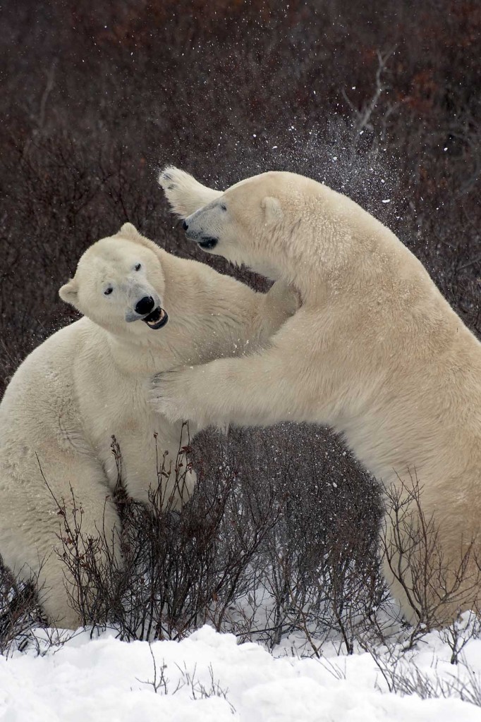
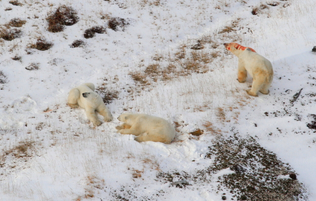
Polar bears sparring in the willows. Colby Brokvist photo.
Whether sparring satisfies staying focused and fit for potential confrontations out on the Hudson Bay ice or displaying dominance for sows, the energy exhausted during the process is substantial. Some bears have not eaten for weeks or even months yet they answer the call to spar as part of their ability to survive within the population.
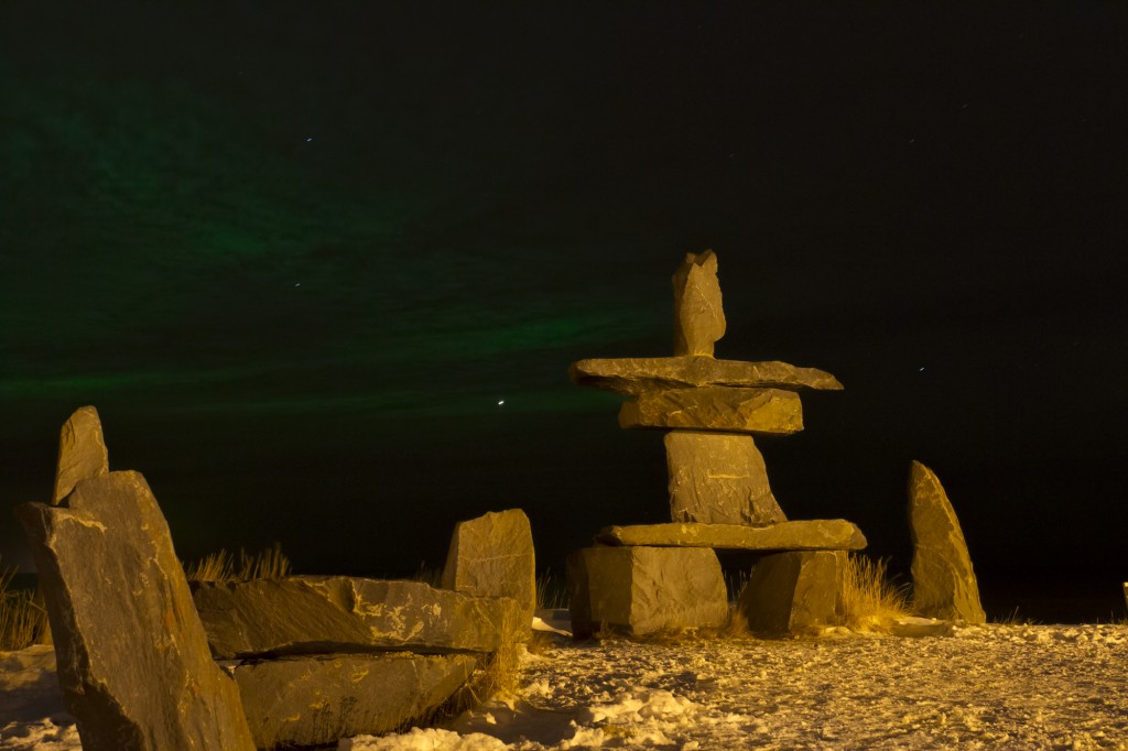
The Inuit meaning of inukshuk is “in the likeness of a human”. Used as a communication beacon in traditional times, these unworked stones compiled in rough human form signaled to others that someone had been there or that followers were on the right path. These landmarks also were built to mark a place of respect or as memorials for loved ones. Churchill has some impressive inukshuks around the area that travelers gravitate to and often photograph in daytime or with dynamic northern lights in the sky over the Hudson Bay.
Northern lights over the Hudson Bay behind the Inukshuk in Churchill. Sean Beckett photo.
Hunters utilize them by marking migration paths or near water where fish are plentiful. Sometimes in these cases, inuksuit are arranged in sequences over short or long distances to better signify the trail. Spiritual meanings have also been associated with these stone sculptures by Inuit peoples. These rock forms are of the oldest and most iconic objects bonding the Arctic with the Inuit people and culture of the north. Inuit tradition does not allow the destruction of inuksuit as they are often thought of as symbolizing ancestors that learned the ways of surviving on the land.
In a land of vast emptiness and barren landscape, a familiar inukshuk is a welcome sight to a traveler on a featureless and forbidding landscape.
An inukshuk can be small or large, a single rock, several rocks balanced on each other, round boulders or flat. Built from whatever stones are at hand, each one is unique. The arrangement of stones indicates the purpose of the marker. The directions of arms or legs could indicate the direction of an open channel for navigation, or a valley for passage through the mountains. An inukshuk without arms, or with antlers affixed to it, would act as a marker for a cache of food.
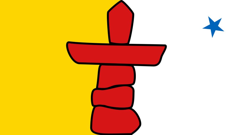
The Inukshuk was the basis of the 2010 Winter Olympics logo designed by Vancouver artist Elena Rivera MacGregor. The form also is featured as the centerpiece of the colorful flag of Nunuvut, the homeland of the Inuit.
The view and expanse of the land from a helicopter gives one a completely different perspective. The boreal forest stands alone from the wide open tundra and the Hudson Bay goes on forever to the north. I never tire of seeing the landmarks as well as the land from the air. Enjoy these photographs of the Churchill region!
Natural Habitat Tundra lodge. Steve Selden photo.
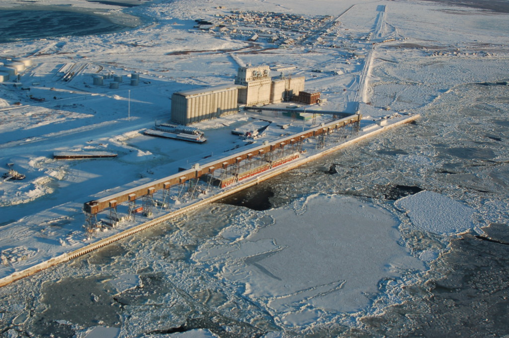
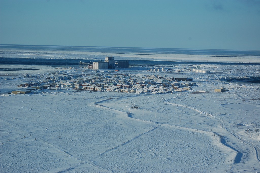
Port of Churchill on the Churchill River. Photo Steve Selden
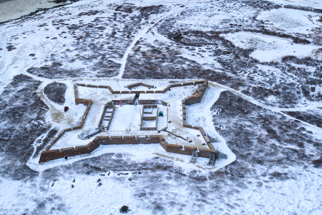
Fort Prince of Wales on the West side of the Churchill River. Steve Selden photo.
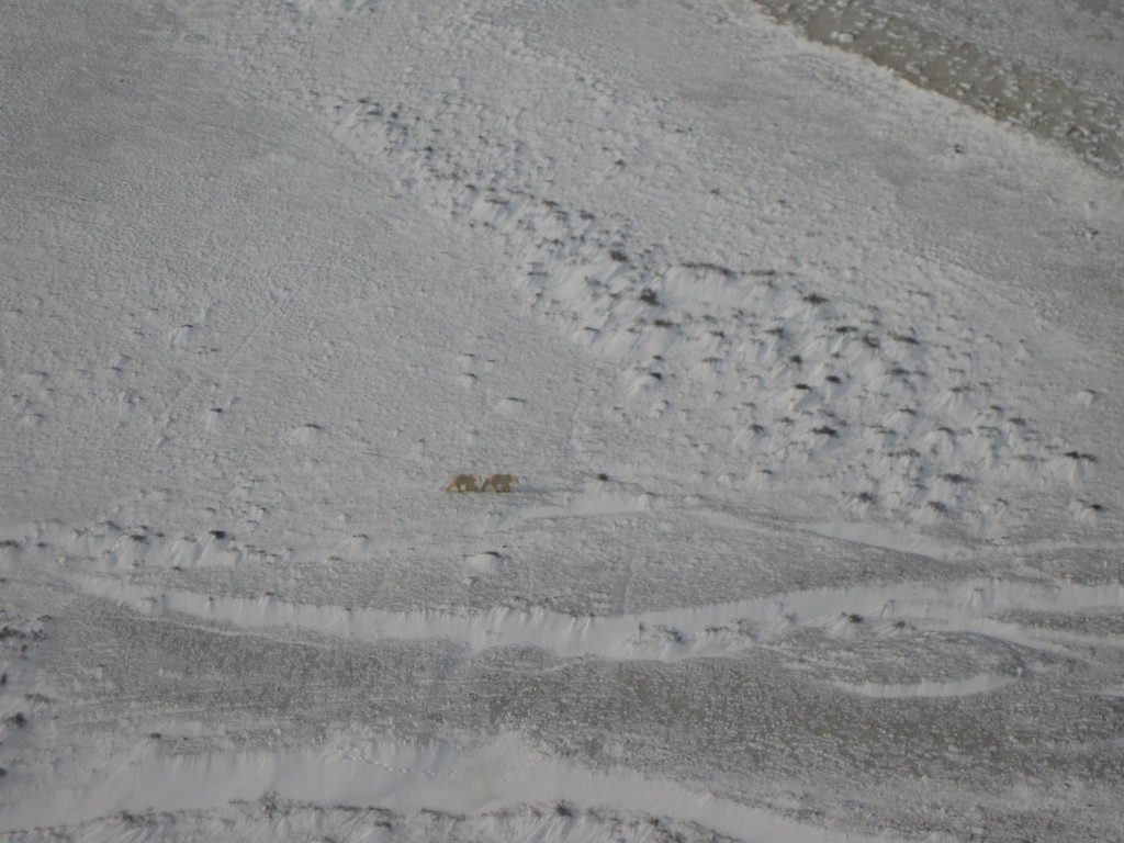
Two polar bears near the coast in November. Karen Walker photo.
Polar bears along the Hudson Bay coast. Natural Habitat Adventures photo.
A view through Churchill, to the port and north over the Hudson Bay. Natural Habitat Adventures photo.
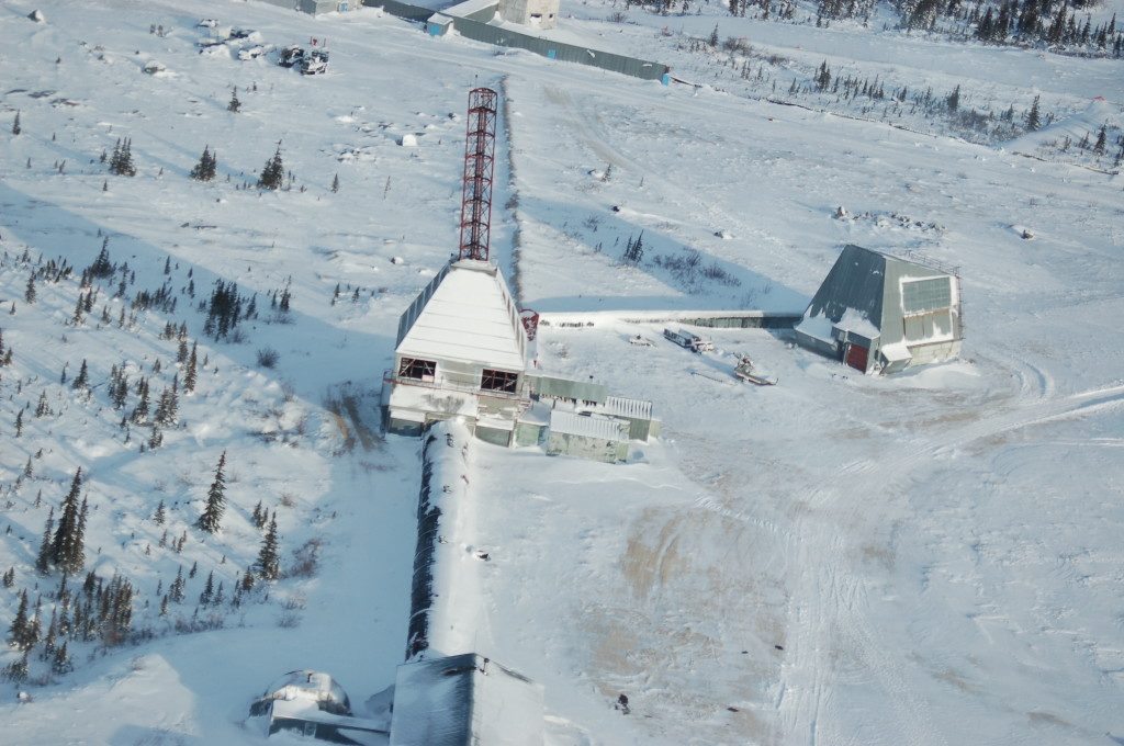
A closer look at the Churchill Rocket Range today. Steve Selden photo.
These fresh images from Churchillian Katie DeMeulles reveal just a glimpse of Spring in Churchill. The main clue is the ice floe edge is fairly close to shore and the open water lead is widening. Of course that could close up again with some north winds but spring is imminent. It’s such an amazing time of year in Churchill!
Willow ptarmigan in the willows. Katie de Meulles photo.
The ice floe edge is closer to shore. Katie de Meulles photo.
Willow ptarmigan camouflaged in the grass. Katie de Meulles photo.
The ice floe edge is close to the rocky shore of Churchill. Katie de Meulles photo.
The Ithaca shipwreck still frozen in the Hudson Bay. Katie de Meulles photo.
Ptarmigan on the Precambrian shield in Churchill. Katie de Meulles photo.